Canadian Properties
Urban Barry Gold Camp
BLITZ PROPERTY
2188.8 Hectares
100% Ownership
100% Ownership
- The Blitz Property is located 5 km north-west of the Grevet Mine and 30 km north-north-east of the town of Lebel sur Quevillion and is accessible by forest access roads connected to highway 113, and is contiguous to or surrounded by Osisko (OSK:TSX).
- A high resolution airborne Magnetic Survey was completed over the complete property in the spring of 2019 outlining several magnetic trends usually associated with E.M. anomalies.
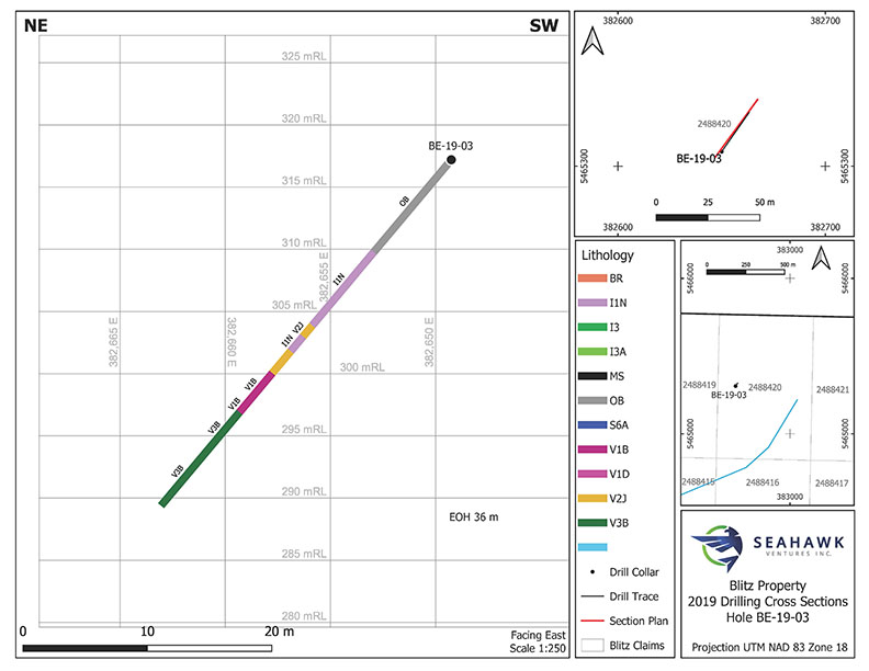
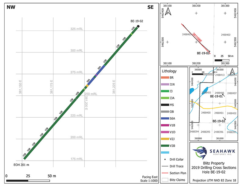
- During 2019 Seahawk completed 434 meters of diamond drilling in 3 holes to evaluate three magnetic structures with associated E.M. anomalies.
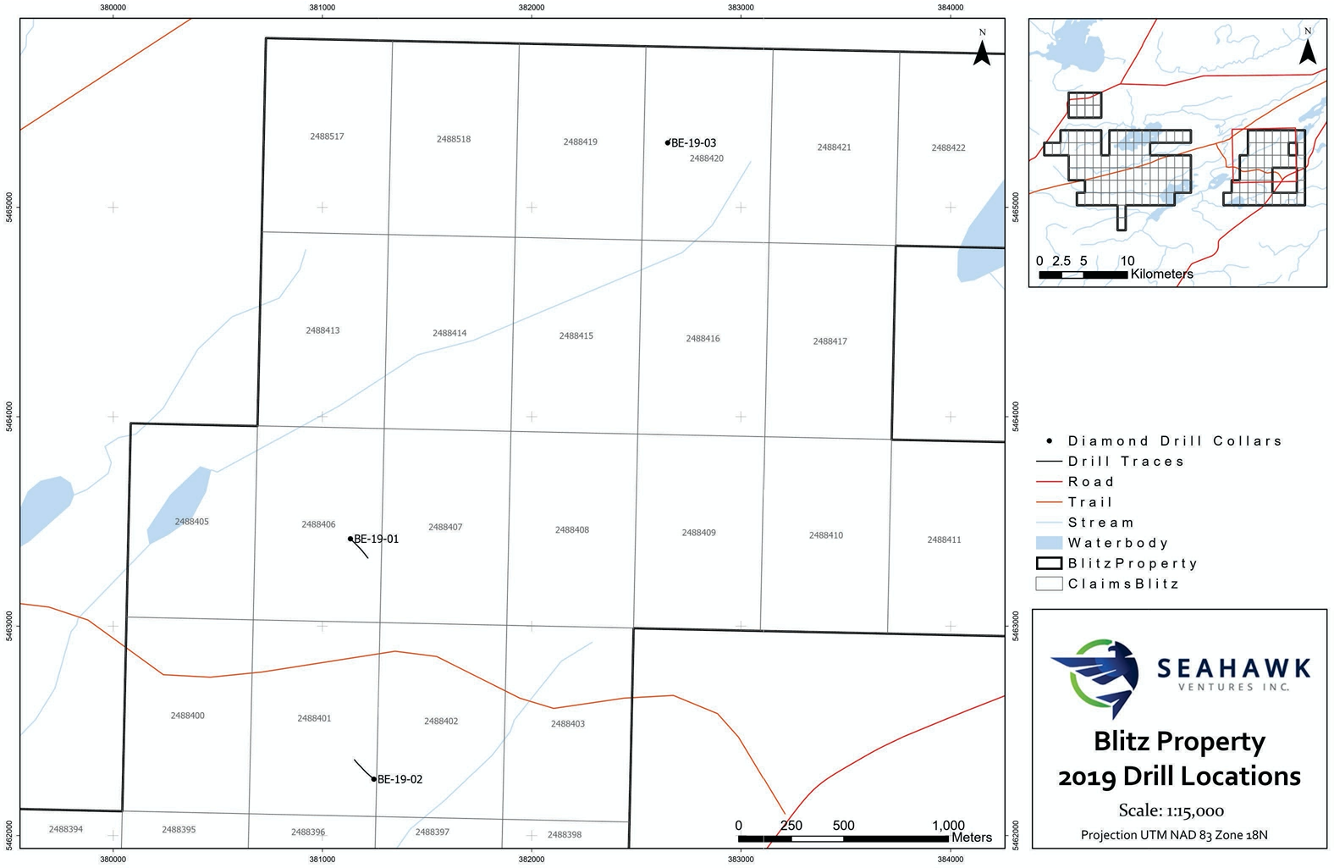
- Significant Au intersections were discovered in Hole BE-19-01 which returned 1.1 g/t Au over 4.4 m including 1.53 g/t Au over 1.1 m.
- Wide highly anomalous intersections of .42 g/t Au over 14.7 m or .40 g/t Au over 16.6 m were also intersected in Hole BE-19-01.
- All the significant Au assays are observed to be associated with sulphide mineralization.
- An exploration program including line cutting, Induced Polarized Surveys and diamond drilling is planned
Drilling Cross Sections
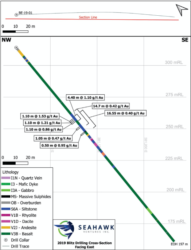
Drilling Locations
Drilling Cross Sections
TOUCHDOWN PROPERTY
1354.47 Hectares
100% Ownership
Gold at surface assayed at 11 g/t and 27 g/t
- The property is accessible by forest access roads connected to a secondary highway from Chapais, Lebel-Sur-Quevillion and Senneterre, the property is contiguous to or surrounded by Osisko (OSK:TSX).
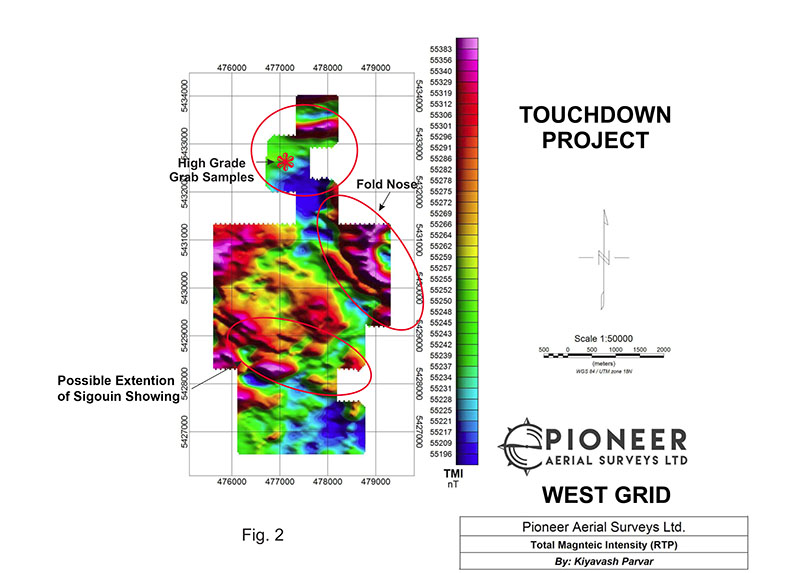
- A High Resolution Drone Mag survey in 2017 defined numerous structures associated with gold occurrences along trend off the claims.
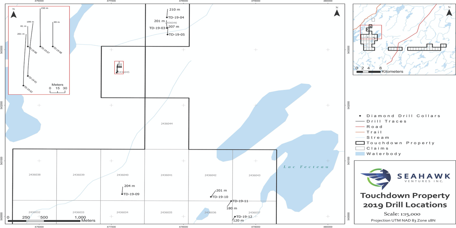
- The 2019 Touchdown Drill program involved 2056 m. in 18 diamond drill holes.
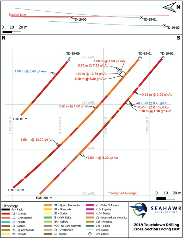
- The diamond drilling program intersected numerous Au intersections, the best being 5.2 g/t Au over 4.1 m including 7.26 g/t Au over .7 m, 4.5 g/t Au over 1.6 m and 13.78 g/t Au over 1.00 m in Hole TD-19-01.
- Another high grade intersection returned 13.32 g/t Au over 1.6m lower down the hole.
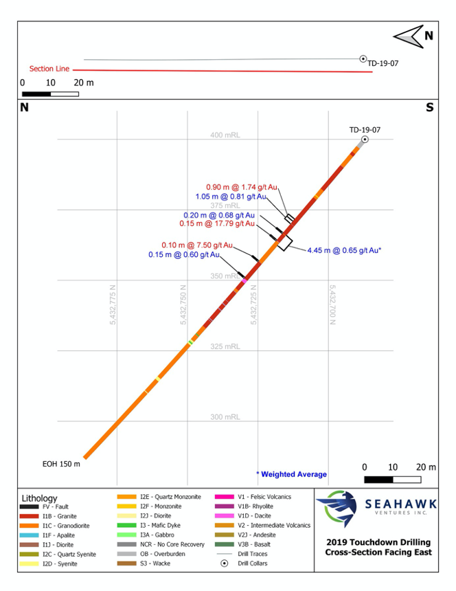
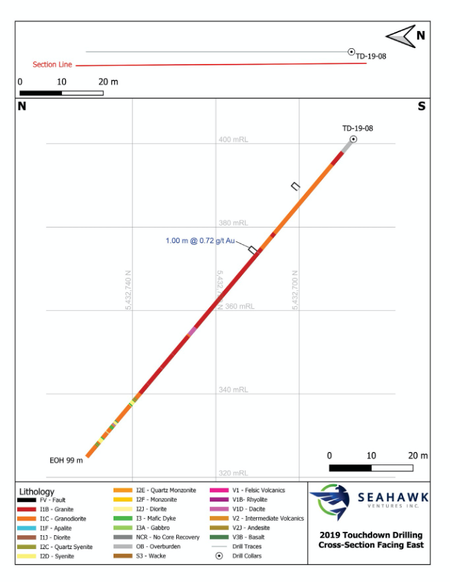
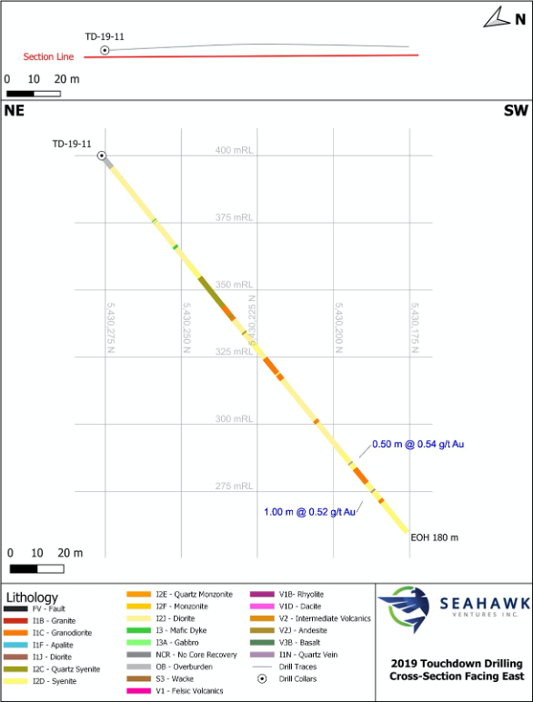
- Numerous highly anomalous (.4 g/t Au to .5 g/t Au) intersections over varying widths were returned in Holes TD-19-01, 02, 06, 07, 08 and 11.
- All the significant Au assays are observed to be associated with sulphide mineralization.
- An exploration program including line cutting, Induced Polarized Surveys and diamond drilling is planned.
Drilling Locations
Drilling Cross Sections
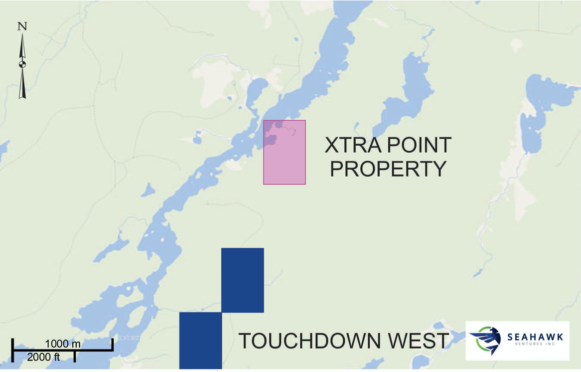
XTRA POINT PROPERTY
56 Hectares
100% Ownership
- In 2018 the 56 hectares property was acquired.
- The property is easily accessible by a network of forest access roads connected to a series of secondary highways from Chapais, Lebel-Sur-Quevillion and Senneterre. The property is contiguous to, or surrounded by Osisko (OSK) and BonTerra (BTR).
- Pre-2017, a Government airborne geophysical survey was completed which identified a distinct linear magnetic structure traversing the property.
- In 2019 a prospecting program found no outcrop on the property but did identify areas of sulphide concentrations in the sand and pebble overburden.
- An exploration program including line cutting, Induced Polarized Surveys and diamond drilling is planned